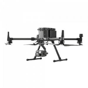
The DJI Matrice 300 RTK is the most advanced commercial / industrial drone on the market with vast capabilities. Compatible with various camera and sensor payloads, the DJI Matrice 300 RTK is ready to complete any task given.
Features
Autonomous Flights.
Interchangeable payload sensors & cameras.
55 minute flight time.
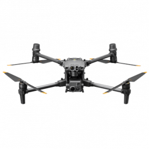
DJI MATRICE M30
The DJI Matrice M30 is a high-performance drone with multiple integrated sensors and a high-resolution camera. With best-in-class flight efficiency and the ability to withstand extreme temperatures and harsh environments, the DJI Matrice M30 is a great inclusion to our arsenal of surveying equipment.
Operating temperatures from -20 to 50 degrees Celcius.
Rapid Deployment.
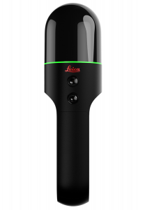
LEICA BLK2GO
The Leica BLK2GO Handheld Imaging Laser Scanner creates a 3D Digital Twin as you move. It captures images and dimensionally accurate point clouds in real-time utilising SLAM technology to record the users trajectory through a space.
Features
Easy to use - All the user needs to do is turn on the scanner and walk.
Fast Scanning Time - The Leica BLK2GO can help users scan a building, structure or other environment in a matter of minutes.
Can capture millions of accurate data points to recreate the space in 3D.
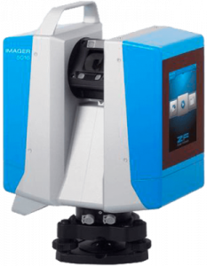
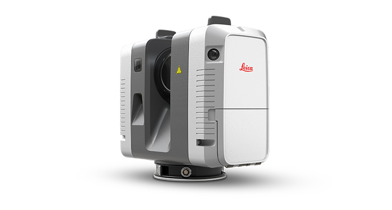
Z+F IMAGER® 5016
The terrestrial 3D laser scanner Z+F IMAGER® 5016 combines compact and lightweight design with the latest 3D measurement technology. As a result, areas of application for the highest demands are made more flexible and expanded. The new terrestrial phase-based 3D laser scanner is equipped with an integrated HDR camera with an illumination system and a positioning system.
Features
Ergonomic streamline design
Fast Image Capture
Integrated LED Spotlights
LEICA RTC 360
The Leica RTC 3D reality capture solution empowers users to document and capture their environments in 3D, improving efficiency and productivity in the field and in the office through fast, simple-to-use, accurate and portable hardware and software.
Features
Capture scans including High-Dynamic Range (HDR) imagery in less than two minutes.
Small and lightweight, the Leica RTC 360 scanner's portable design and collapsible tripod mean it is compact enough to fit into most backpacks, ready to be taken anywhere.
Low noise data allows for better images, resulting in crisp, high-quality scans that are rich in detail and ready for use in a range of applications.
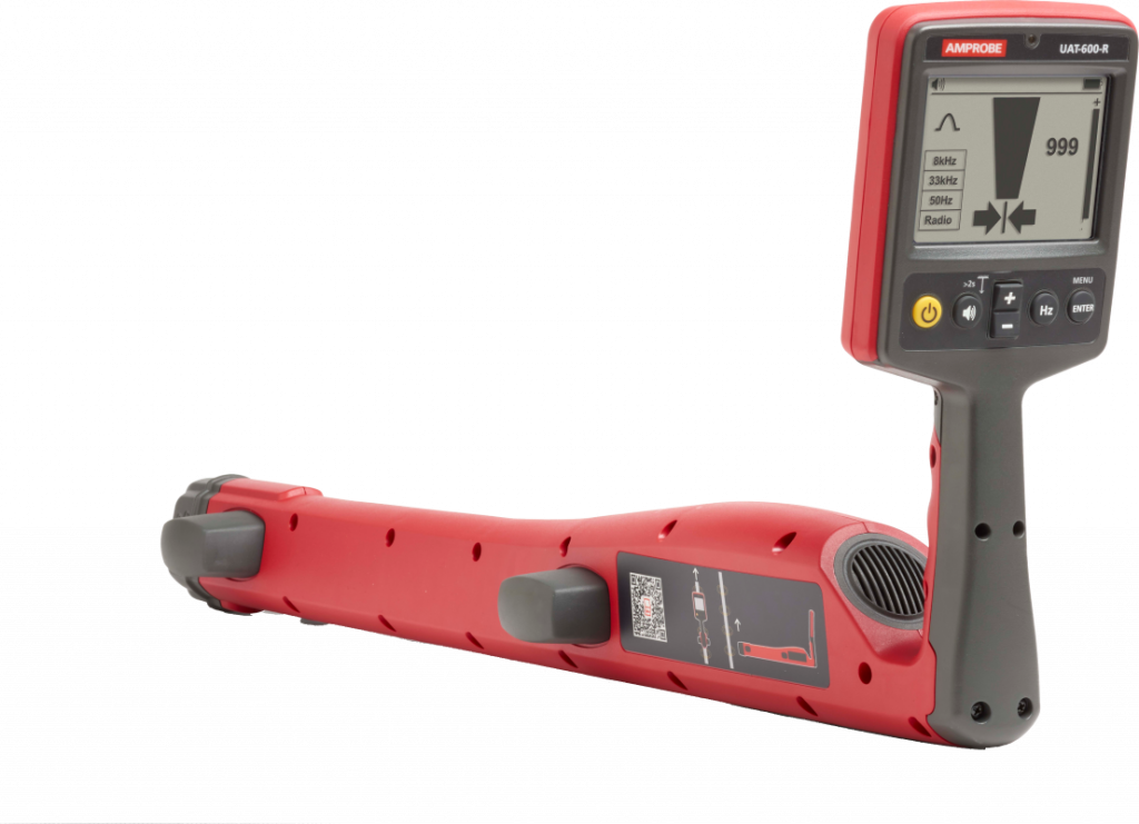
AMPROBE UAT-600-R
The Amprobe UAT-600-R Underground Utilities Locator is designed to accurately pinpoint underground utilities and buried services up to 100 feet deep with depth measurement accuracy to 20 feet.
Features
Different testing modes for a wide range of applications; Passive Power Mode, Passive Radio Mode & Active Mode.
Three active modes using the UAT-600-T Transmitter; Induction, Direct Connection with Test Leads & Clamp.
CAT IV 600 V rated for safety when working with energized cables.
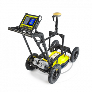
NOGGIN® SMARTCART NG250
Features
The Noggin® SmartCart NG250 is an adaptable, high performance ground penetrating radar that uses electromagnetic pulses to identify void spaces, buried pipes, conduits and other structural elements hidden within the ground.
Durable, 4-wheeled folding cart.
Able to navigate most terrains; flat to moderately rough.
Ability to discover and detect elements up to 30 metres below the Earth's surface.
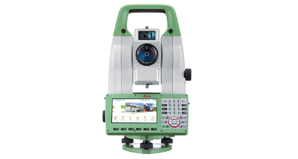
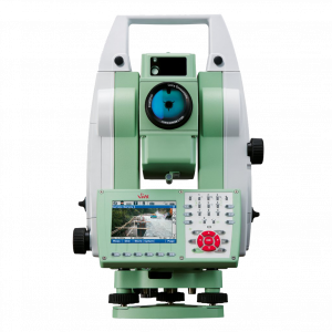
LEICA VIVA TOTAL STATION TS16
Meet the world’s first self-learning totalstation. Automatically adjusting to any environmental conditions, the Leica Viva TS16 locks onto your, and only your, target. Regardless of how challenging the task or the amount of distractions in the field, this total station exceeds your expectations. The Leica TS16 is a benchmark for surveying accuracy. Whether you want to stake out an object on a construction site, need accurate measurements of a tunnel or a bridge, or survey a parcel of land – you need reliable and precise data.
Features
Comes with the revolutionary Captivate software, turning complex data into the most realistic and workable 3D models.
Can be controlled using Leica CS20 Field Controller.
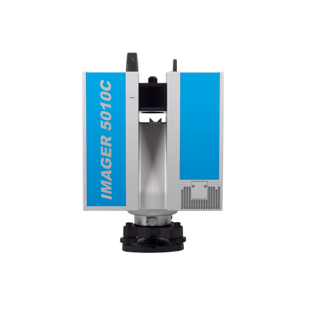
Z+F IMAGER® 5010C
The terrestrial 3D laser scanner Z+F IMAGER® 5010C sets new standards for laser scanning. The integrated camera allows combining brilliant colours with high-resolution scan data. HDR-technology guarantees perfect illumination in all parts of the scene.
Features
Integrated calibrated camera.
Best balanced colour imagery through Z+F High Dynamic Range Technology.
80 Mpixel full panorama generation.
Extreme high speed laser sensor.
Total eyesafety guaranteed by laser class 1.
IP 53 conformity: dust & water resistant.
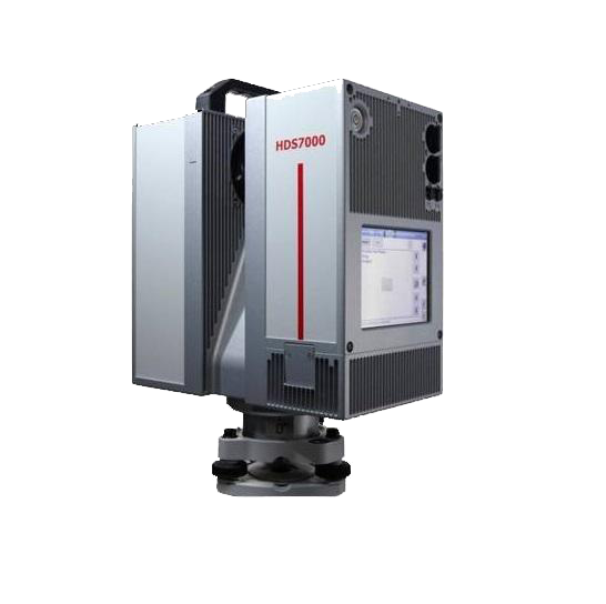
Leica HDS 7000
The Leica HDS 7000 is the upgraded model of the Leica HDS 6200 and features a longer range of scanning and extremely high scan resolution which makes it possible to obtain a high levels of details of objects to be scanned.
Features
Fully operational between bright sunlight and complete darkness.
Maximum scan rate of over 1 million points per second at a 187 m range, based on ambiguity intervals.
Laser plummet capability with a centering accuracy of 0.5mm / 1m.
Ethernet or integrated Wireless LAN communication.
Self-check at startup.
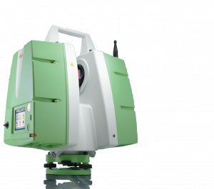
leica scanstation p20
The Leica ScanStation P20 is a compact, ultra-high speed pulsed laser scanner with survey grade accuracy, range and field-of-view with an integrated camera and laser plummet. It provides ultra-high speed time-of-flight enhanced by Waveform Digitizing (WFD) technology.
Features
Fully operational between bright sunlight and complete darkness.
Maximum scan rate of over 1 million points per second at a 187 m range, based on ambiguity intervals.
Integrated solid-state drive or external USB drive storage.
Integrated high resolution digital camera with zoom video.
Linearity error ≤ 1 mm.
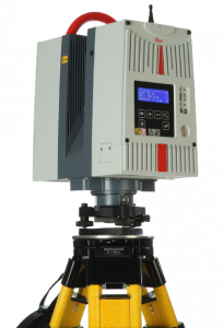
Leica hds 6200
The Leica HDS6200 unlocks the full potential of ultrahigh speed, “phase-based” laser scanning technology for fast, productive as-built surveys. “Next-generation” advances in speed, portability, data quality at range, temperature capabilities and tilt sensor integration all combine to deliver significantly lower project costs. The Leica HDS6200 lets users profit from the inherent speed advantage of phase-based scanners for a wider range of as-built and site surveys.
Features
Fully operational between bright sunlight and complete darkness.
Maximum scan rate up to 1 million points per second at a 79 m range, based on ambiguity intervals.
Dual-axis sensor.
Operates between -10° C to +45° Celcius.
Leica Viva total station TS15
The Leica Viva TS15 uses years of experience to optimally combine the world’s best total station sensors for angles, distances, drives and the patented PowerSearch target recognition camera. It optimizes productivity with exact photo documentation of site conditions.
Features
Image Notes.
Image Assisted Surveying.
PowerSearch finds your prism within seconds.
A note to our visitors
This website has updated its privacy policy in compliance with changes to European Union data protection law, for all members globally. We’ve also updated our Privacy Policy to give you more information about your rights and responsibilities with respect to your privacy and personal information. Please read this to review the updates about which cookies we use and what information we collect on our site. By continuing to use this site, you are agreeing to our updated privacy policy.