Accurate. Fast. Safe.
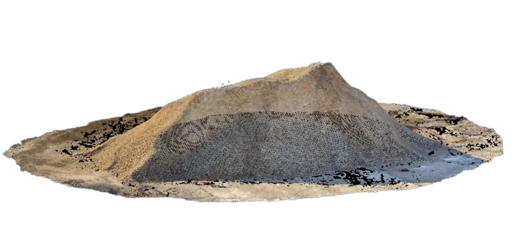
At AIMS, we offer advanced stockpile measurement services using high-resolution 3D laser scanning technology. Whether you’re managing aggregates, raw materials or waste, we deliver precise volume calculations that support inventory control, audit compliance and operational planning.
Our laser scanning method captures millions of data points across the surface of each stockpile, creating a detailed digital model without the need for physical contact or manual measurements. This not only increases accuracy but also improves safety by eliminating the need for workers to climb or walk on unstable materials.
Key Benefits:
Volume accuracy within ±2%
No disruption to ongoing operations
Safer alternative to traditional walkover methods
Quick data turnaround (typically within 48 hours)
3D visualizations and reports included
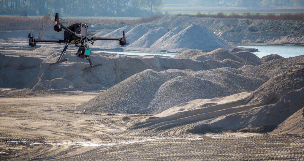
Drone LiDAR for Stockpile Measurement
High-Accuracy Volumes from the Sky
We offer cutting-edge stockpile measurement services using Drone LiDAR technology, ideal for large or complex material piles that are difficult to assess using ground-based methods.
Our drones are equipped with high-resolution LiDAR sensors capable of capturing millions of data points from above, generating accurate 3D models of your stockpiles even in challenging terrain or expansive sites. This allows us to deliver quick, safe and highly accurate volumetric reports without disrupting your operations.
Why Use Drone LiDAR for Stockpiles?
Ideal for large-scale and hard-to-access piles
Volume accuracy within ±2%
Faster coverage of multiple stockpiles in a single flight
Minimal ground disruption or manual setup
Fully georeferenced data for inventory integration
Supports frequent monitoring for production and reconciliation
Whether you’re managing aggregate yards, quarries, landfills or construction materials, our Stockpile Measurement solutions provide a safe, scalable and efficient way to track inventory and reduce measurement errors.